Elevate Your Projects with EnviroDroneTech’s Comprehensive Drone and GIS Services
Enhance your project with high-quality aerial imagery and expert consulting.
Elevate Your Projects with EnviroDroneTech’s Comprehensive Drone and GIS Services
Enhance your project with high-quality aerial imagery and expert consulting.
Elevate Your Projects with EnviroDroneTech: Unmatched Aerial Solutions
Precision and Clarity
Our state-of-the-art drones deliver ultra-clear images and videos, providing you with detailed insights that ensure informed decisions and superior project outcomes.
Comprehensive Coverage
From hard-to-reach inspection points to expansive site surveys, our drones cover every angle, offering a complete view that traditional methods can't match.
Customized Solutions
We tailor our drone services to meet your specific needs, whether it's real estate marketing, construction monitoring, or environmental assessments, ensuring you get exactly what your project requires.
Our Services

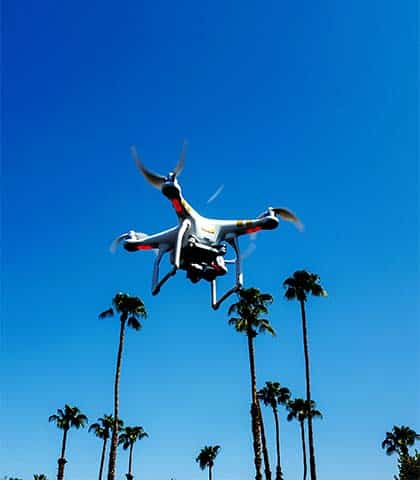
Drone Photography & Videography Services
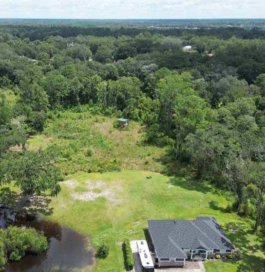
EnviroDroneTech offers high-resolution aerial imagery for real estate, construction, and business promotion. Our drone services provide unique perspectives that help projects stand out and offer clarity and detail for tracking progress or showcasing properties.

Construction Progress Photos
EnviroDroneTech provides regular aerial photo updates for construction projects, capturing all phases from start to finish. These photos help managers and stakeholders monitor progress, stay on schedule, and maintain budget control.

Asset Identification & Property Inspection
EnviroDroneTech’s drone inspection services offer a safer and more efficient way to inspect hard-to-reach areas like roofs and towers. Ideal for insurance, property management, and maintenance, these services provide detailed, accurate assessments without the need for risky, traditional inspection methods.
Pre- and Post-Hurricane Property Conditions
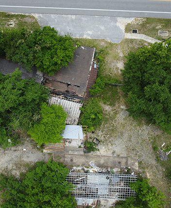
EnviroDroneTech captures high-resolution images of properties before and after hurricanes, helping with insurance claims and repairs. Their services offer crucial documentation of property conditions, providing peace of mind during hurricane season.

Environmental Due Diligence
EnviroDroneTech provides environmental due diligence services, including Phase I Environmental Site Assessments (ESAs). EnviroDroneTech leverages drone technology to conduct more thorough assessments, helping reduce environmental liability for your projects.

Updated Orthoimagery & GIS Mapping
EnviroDroneTech delivers precise, up-to-date aerial maps and orthoimagery for various applications, including GIS mapping and AutoCAD drafting. These services are essential for site planning, environmental monitoring, and land management.
Why Choose EnviroDroneTech?
At EnviroDroneTech, we combine cutting-edge technology with expert knowledge to provide our clients with unparalleled drone services. Whether you're looking for stunning aerial imagery, detailed site inspections, or expert environmental consulting, we have the experience and equipment to deliver results that exceed your expectations. Our commitment to quality, safety, and customer satisfaction sets us apart in the industry. Let us show you how our drone services can elevate your project and provide you with the data and insights you need to succeed.
Experience the EnviroDroneTech difference. Contact us today to learn more about our services and how we can help you achieve your project goals.
Unique Perspective
Drones capture detailed aerial views that highlight features traditional methods can't, enhancing project visibility.
Efficiency and Safety
Drones access hard-to-reach areas quickly and safely, reducing the need for ladders or scaffolding.
Cost-Effective
Drones cut down on labor and equipment costs, offering high-quality results at a lower price.
What our Clients Say
Take Your Project to New Heights
Unlock the Full Potential of Aerial Imagery Today
